Context
Why this place matters
A place like nowhere else
The Lower Balonne is no ordinary stretch of river. Its scale, its wildlife, and its deep cultural meaning make it one of the most remarkable floodplains on the continent.
Half the size of Switzerland
It makes up about 13% of the Murray-Darling Basin.
The Lower Balonne floodplain spreads across an area roughly half the size of Switzerland, about 13% of the whole Murray-Darling Basin.
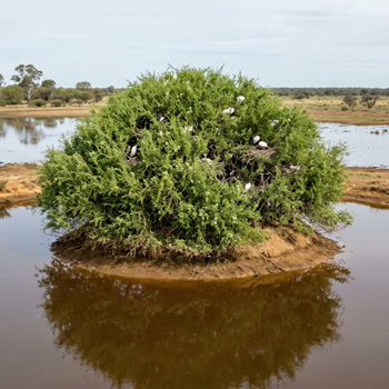
Narran Lakes
A Ramsar-listed wetland of international importance.
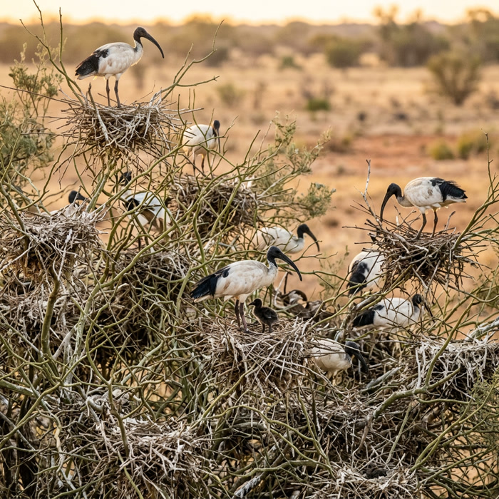
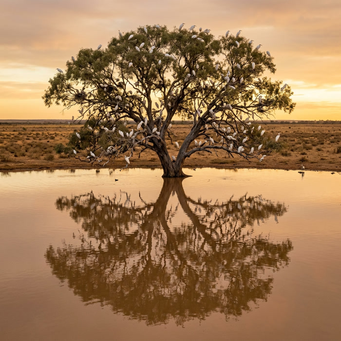
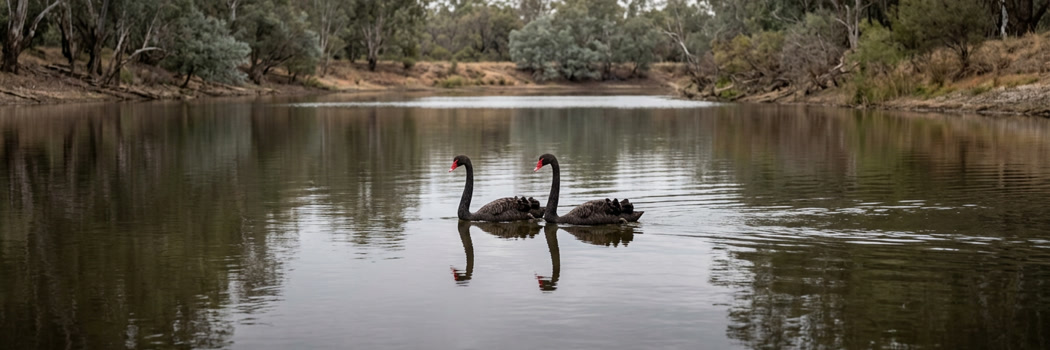
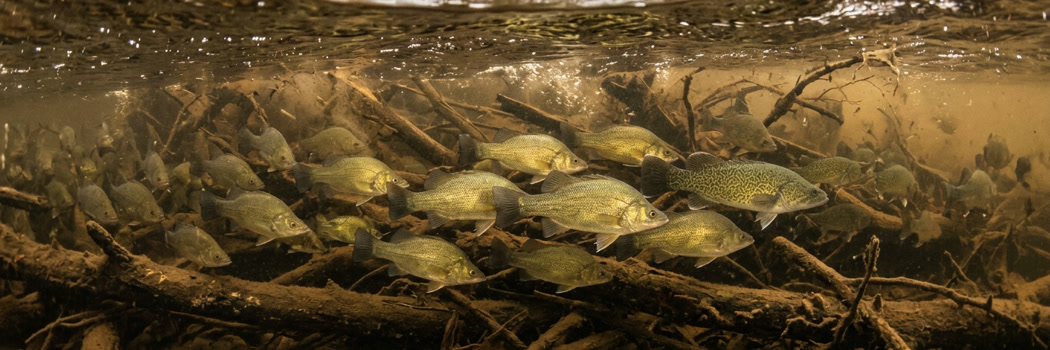
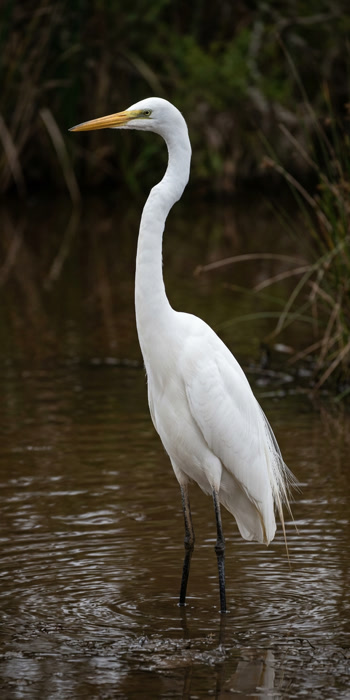
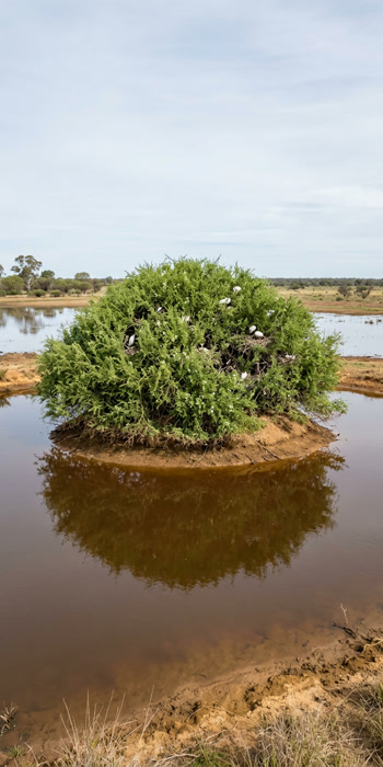
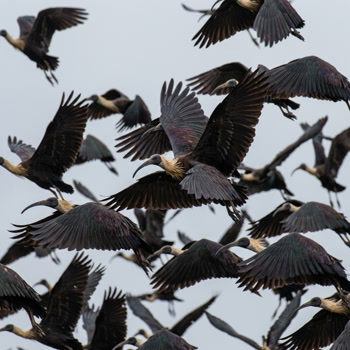
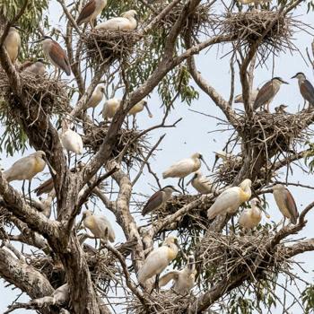
Narran Lakes is a Ramsar-listed wetland: 44 breeding waterbird species, more than 130,000 nests in 2012, and 11 native fish species including Murray cod.
Dharriwaa and Burrul Guumin
First Nations names for this Country: "Meeting Place" and "Big Water".
First Nations peoples know this place as Dharriwaa ("Meeting Place") and Burrul Guumin ("Big Water"). The catchment has a high First Nations population.
A rare inland delta
One of the few river systems on Earth that spreads out inland.
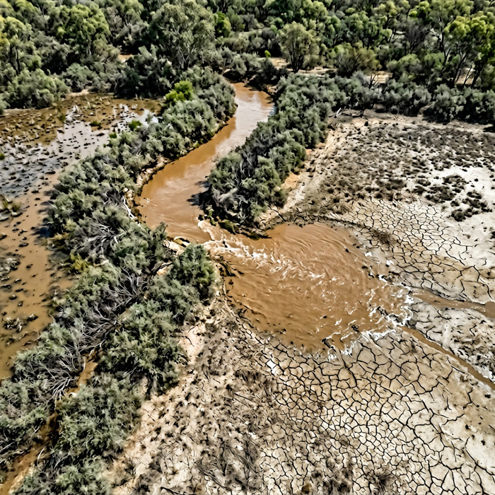
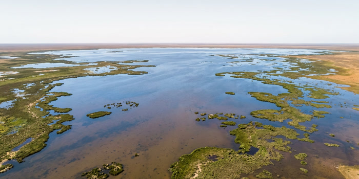
The Lower Balonne is one of the rare inland deltas on Earth: a river system that fans out across the land instead of reaching the sea.
A geography lesson
Rory Treweeke traces the catchment from the top down, naming each river as the water leaves the main channel. Watch the map as he names them.
Rory Treweeke, Lower Balonne
It is like blood through the veins
It's like blood. You take the Murray-Darling Basin, now you look at it. You got all those little rivers coming out of it, creeks, which you've got in your heart. You got those blood vessels. Same thing, isn't it?
The channels are the vessels. The annual flow is the heartbeat. Watch it beat year by year as the Culgoa reaches left and the Narran reaches right, and see the years the pulse runs thin. The earliest years, back in the 1960s and early 1970s, are close to the river's natural pulse, before much of the water development that followed. Watch how it changes as the decades pass.
What a flood reaches
Drag the slider from a barely-connecting fresh to a major flood and watch the floodplain fill. These are historical CSIRO event extents ordered by magnitude, not a live hydraulic model.
The floods are not a disaster here. The right flood at the right time is the best thing that can happen to this country.


What It Feeds
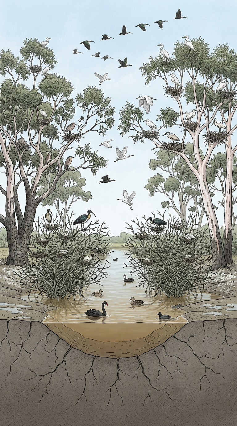
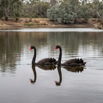
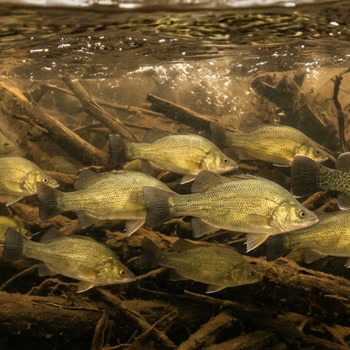
The environment depends on the same rhythm. Flow governs movement, persistence and recovery of fish and waterbirds, making connectivity central to ecological function.
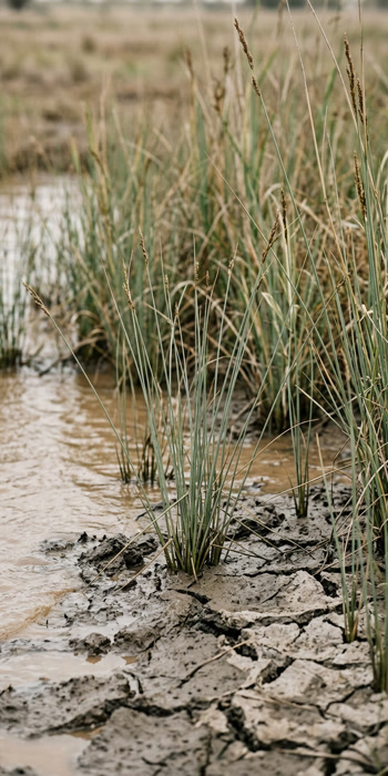
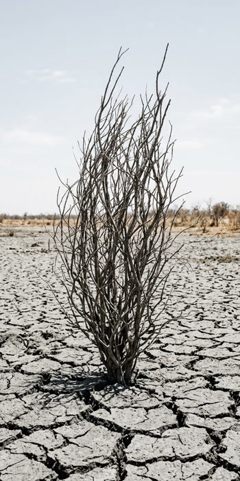
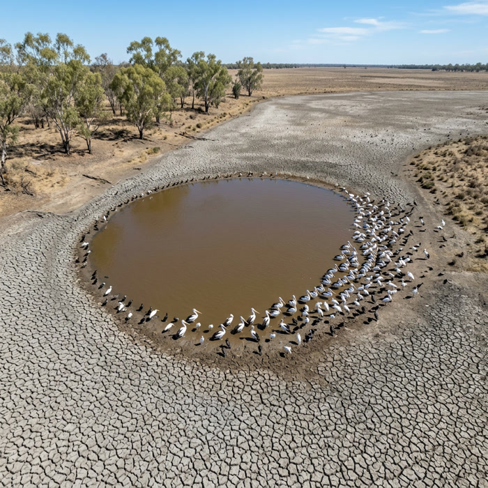
In dry times the rivers contract into refuge waterholes; when flows return, channels reconnect, enabling spawning, dispersal and recolonisation.
Vegetation tells the same story. Episodic floods and long dry intervals create a shifting mosaic of woodlands, lignum shrublands and wetland plant communities. The pattern and frequency of flooding is the engine of growth, habitat and resilience.

The Infrastructure
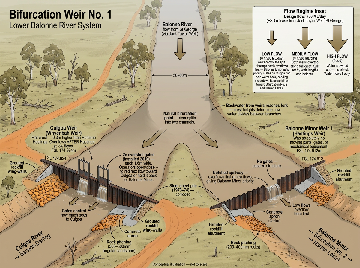
Queensland river operations rules ensure the first 730 megalitres per day of inflows into Beardmore Dam are passed downstream, for environmental, stock, and domestic needs, before any irrigation diversion occurs. Fixed-crest bifurcation weirs determine how that water is shared between the four distributary channels during each flow event.
These rules help maintain basic low-flow connectivity, but whether water flows through the whole system depends on event size and the condition of each channel: whether much of the riverbed is dry and waterholes need to be topped up.
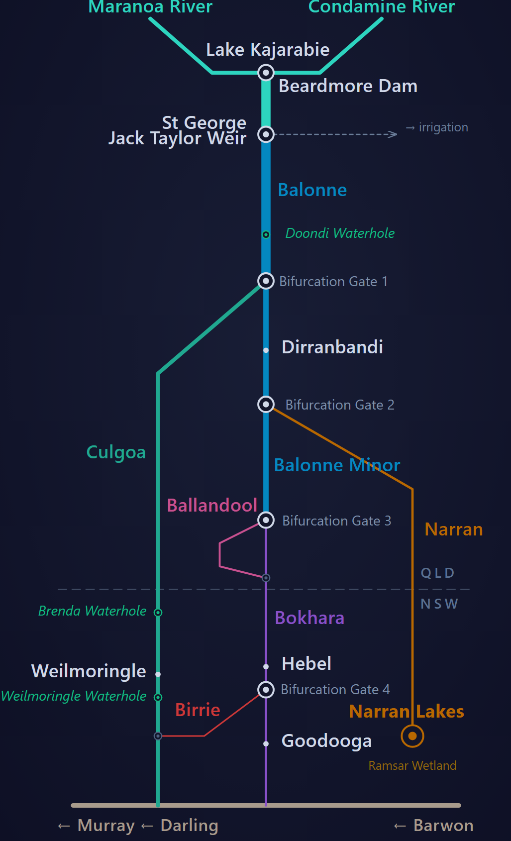
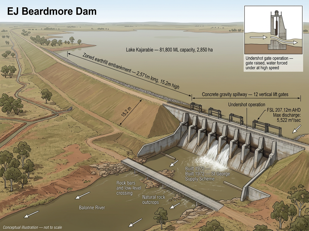
EJ Beardmore Dam
The largest barrier on the Balonne River. A 2.5-kilometre zoned earthfill embankment with a concrete gravity spillway containing 12 undershot vertical lift gates. Built in 1972, it stores 81,800 megalitres in Lake Kajarabie, the main water supply for the St George irrigation scheme.
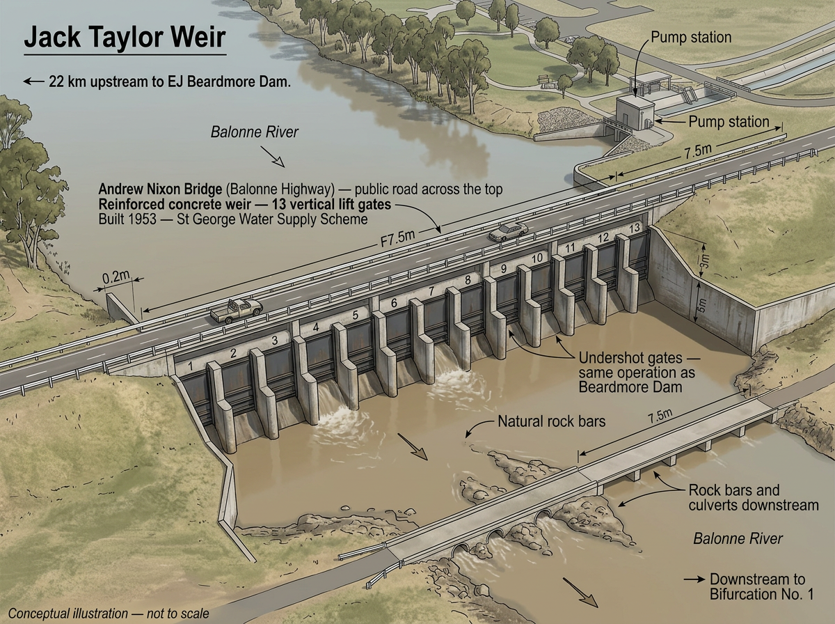
Jack Taylor Weir
A reinforced concrete weir with 13 vertical lift gates and a public road bridge (Andrew Nixon Bridge) across the top, located at the edge of St George. Built in 1953, it stores 10,270 megalitres and feeds the irrigation channel system via a pump station on the eastern bank. Twenty-two kilometres downstream of Beardmore Dam.
Bifurcation Weir No. 1
Where the Balonne River first divides, splitting into the Culgoa River (west, toward the Barwon-Darling) and the Balonne Minor (south, toward Narran Lakes via Bifurcation No. 2). Two corroded steel sheet-pile weirs, built 1973 to 1974. The Culgoa weir received two small overshot gates in 2019, the only actively controllable element in the entire bifurcation system.
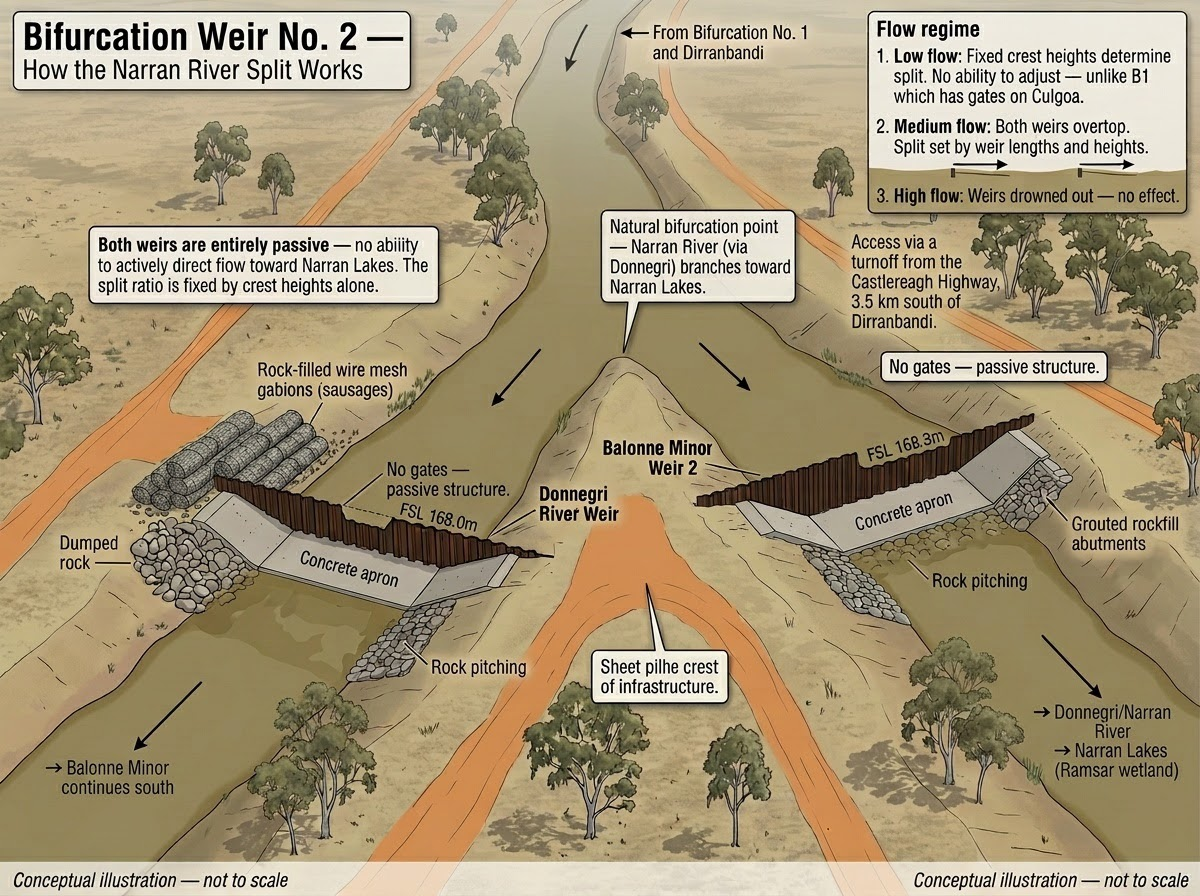
Bifurcation Weir No. 2
Where the Donnegri River (leading to Narran Lakes, a Ramsar-listed wetland and major waterbird breeding site) branches from the Balonne Minor. Both weirs are entirely passive: there is no ability to actively direct flow toward Narran Lakes. The split ratio is fixed by crest heights alone.
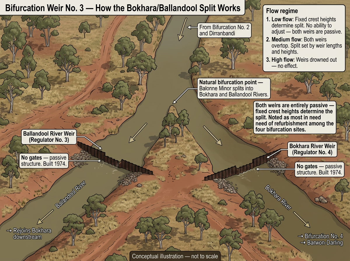
Bifurcation Weir No. 3
The Balonne Minor splits again into the Bokhara River (continuing toward the Barwon-Darling) and the Ballandool River (which later rejoins the Bokhara). Both weirs are passive, built 1974. Noted as the most in need of refurbishment among the four bifurcation sites.
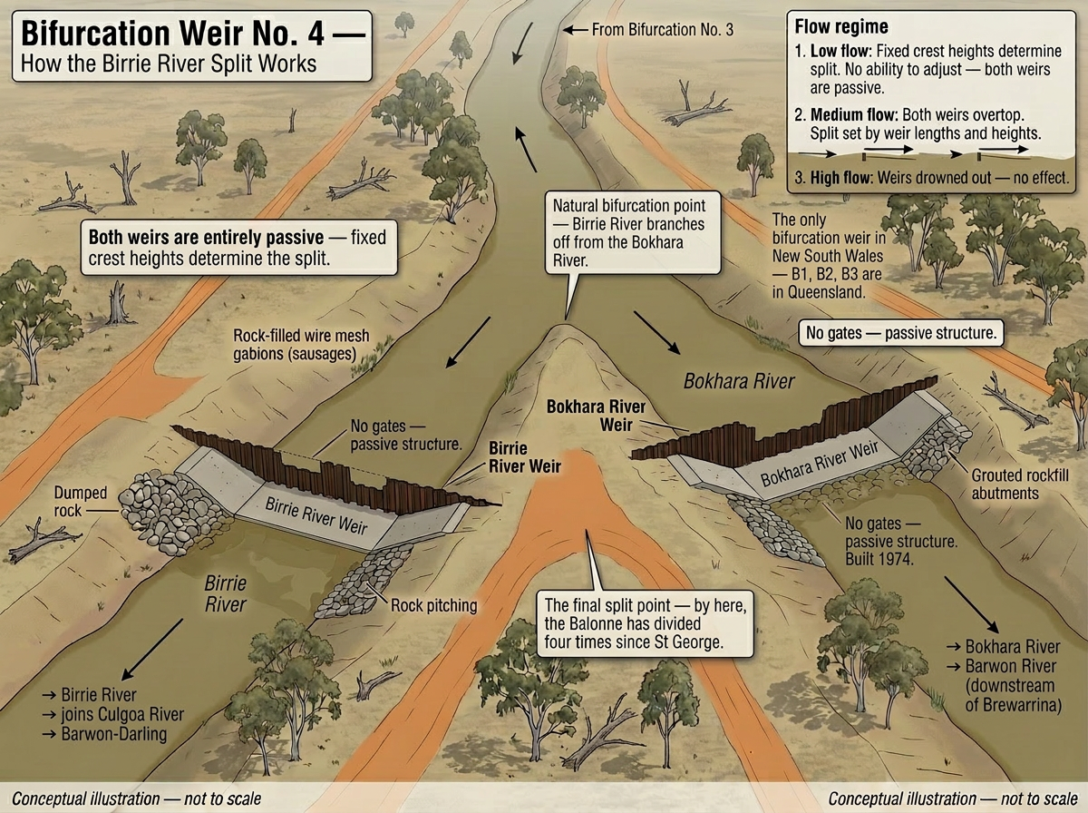
Bifurcation Weir No. 4
The final split: the Birrie River branches off the Bokhara near Goodooga, NSW. The only bifurcation weir in New South Wales. Both weirs are passive, built 1974, and in poor condition. No confirmed dimensions and no photographs exist. By this point the Balonne has divided four times since St George. Both channels ultimately reach the Barwon-Darling.